The research unit “Analysis and conservation of plant diversity” carries out experimental research in the field of plant ecology and conservation biology, focused on the analysis of plant communities.
Vegetation plays a fundamental role in the structure and functioning of ecosystems and in the ecosystem services they provide. It represents the key element to identify and analyse habitats, to assess their conservation status, to study spatial patterns and ecological processes at landscape scale, to provide fundamental information for land-use planning and management, especially in relation to current climate and environment issues.
The research group mainly deals with:
• analysis, monitoring and conservation of vegetation and habitats
• mapping of vegetation and habitats
• analysis of land use and land cover changes
• environmental monitoring using bioindicators
• floristic analyses
• assessment of plant species according to the IUCN Red List system; monitoring and conservation of native plant species
• alien and invasive alien plant species (IAS)
• urban ecology: green infrastructures and nature-based solutions
Research activities are based on fieldwork, advanced GIS methods and satellite and proximity remote sensing.
GIS make it possible to visualize and integrate various types of territorial information and to analyse the spatial features and temporal trends of transformation of the landscape.
The use of remote sensing tools, either aerial or satellite-based, allows the gathering of many kinds of information at different spatial scales, the analysis of aspects that can be difficult to monitor from the ground, the monitoring of ecosystems and of the landscape over time, also in response to climate change. The recent advent of proximal or low altitude remote sensing using small drones (RPAS) opens up new perspectives for the study of the vegetation landscape. On the basis of the high-resolution images acquired by drones it is possible to produce very detailed vegetation maps, including unreachable or unsafe areas. With particular sensors mounted on drones it is possible to acquire multispectral and hyperspectral images which provide important information for the analysis and monitoring of a territory.
Our goal is to address issues concerning ecology and natural resource conservation through an interdisciplinary integrated approach of fieldwork and remote sensing, from the plant population and community to the landscape scale.
The main lines of research currently focus on:
Conservation of karst dry grasslands, other grasslands and permanent meadows
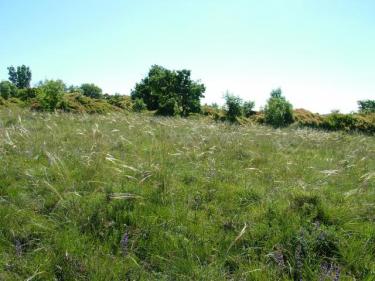
Dry grasslands and permanent meadows are habitats very rich in species, shaped through time as the result of low-intensity human activities; they are recognized by the Habitats Directive (92/43/EEC) as habitats of conservation interest at the European level. Abandonment of traditional agricultural and grazing practices, the consequent natural process of development of scrubs and woodland, urbanization and the spread of monocultures with regard to permanent meadows are causing a strong reduction of these valuable habitats.
A specific research program is dedicated to the monitoring of Karst grasslands, the effects on plant communities of deforestation and grazing as conservation measures, and the impacts of alien plant species on these fragile habitats.
Inland waters and wetlands
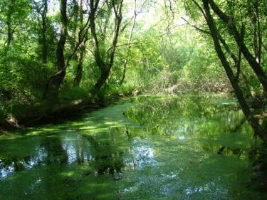
Inland waters and wetlands are habitats with high ecological value dramatically declining as consequence of land-use changes, human alteration, global warming and natural dynamic processes. The loss and the degradation of these habitats are a major threat to biodiversity and to the ecosystem services they provide, also in relation to the problem of climate change.
Researches are focused on the plant diversity of inland waters and wetlands of the classic Karst area (karst lakes and ponds) and of the lowland-coastal area of Friuli Venezia Giulia, aquatic and riparian vegetation of watercourses, mires and fens.
A line of research deals with wet riparian and alluvial plain forests, now reduced to small residual patches in the Po Valley. These hygrophilous and meso-hygrophilous forest formations are fundamental elements for ecological networks, green and blue infrastructures and the resilience of the Po Valley landscape.
A research project is dedicated to the flora, vegetation and habitat monitoring of Lake Doberdò, one of the most important examples of karst hydrology in Italy and Europe.
Coastal dunes
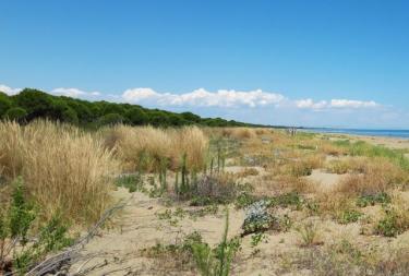
A line of research deals with the analysis and monitoring of dune ecosystems through field survey of plant communities, acquisition of data on the functional traits of the species and analysis of high-resolution images acquired by drones.
